Wind Lake Water Quality
The WLMD contracts the U.S. Geological Survey (USGS) (a division of the U.S. Department of Interior) to collect water quality information on Wind Lake. There is now a 30 year history of information.
Water quality information is very important in planning and implementing lake management activities. The data can show whether or not a project has been successful in meeting its goals, or whether a new problem is occurring. It is important to remember that 30 years of data is only a small snapshot in the life of a lake. Trends can be seen only after years of information are available.
Samples are collected in April, June, July, August, October and February. The data include: dissolved oxygen, nutrients (phosphorus and nitrogen), pH, conductivity, clarity, suspended solids, temperature and others. The most recent information is available at the Annual Meeting held in September.
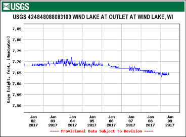
The USGS also maintains an automatic lake level recorder that is located at the Wind Lake Dam. The recorder measures the level of the water in the lake every 15 minutes, 24 hours a day, 365 days per year. The information is now being uploaded to the USGS web site for almost instant retrieval.